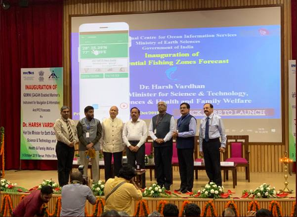
New Delhi: In a major technological breakthrough that will fill the gap in emergency communication and information to fishermen, the government on October 9 launched a low-cost indigenous satellite-based communication device ‘Gagan Enabled Mariner’s Instrument for Navigation and Information’ (GEMINI).
“The communication gap was severely felt during the Ockhi cyclone in 2017, when fishermen went out, for deep-sea fishing before the onset of the cyclone and could not be informed about the developing cyclone. This communication gap resulted in loss of life, serious injuries to those rescued and severe damages to fishing boats and fishing gear,” said Health Minister Harsh Vardhan while inaugurating GEMINI.
This will enable seamless and effective dissemination of emergency information and communication on disaster warnings, Potential Fishing Zones (PFZ) and Ocean States Forecasts (OSF) to fishermen.
“The satellite-based communication is the only suitable solution for the dissemination of such emergency information and affordable satellite-based communication system should be made part of the dissemination chain to deal with cyclones, high waves and tsunamis,” the minister added. Pradeep Singh Kharola (Secretary, Ministry of Civil Aviation) and Madhavan Nair Rajeevan (Secretary, MoES) were also present on the occasion.
The new device works using communication system GPS Aided Geo Augmented Navigation (GAGAN) to transmit the PFZ, OSF and disaster warnings to fishermen with system consisting of three geosynchronous satellites (GSAT-8, GSAT-10 and GSAT-15).
This device receives and transfers the data received from GAGAN satellite to the mobile through Bluetooth communication. A mobile application developed by INCOIS decodes and displays the information in nine regional languages.
Presently, the advisories are not able to disseminate information through multiple communication modes including the disaster warnings, when the fishermen move away from the coast beyond 10-12 km (typical ranges of mobile phones and VHF). That remained as a major limitation in disseminating the information to fishermen who go in the sea beyond 50 nautical miles; sometimes up to 300 nautical miles and beyond to conduct multi-day fishing.
He also launched the improvised version of Potential Fishing Zones (PFZ) forecasts developed by INCOIS, which will provide advisories on PFZ to fishermen 3 days in advance. The forecasts are generated using numerical models operationalized by INCOIS and helps overcome the operational difficulties in providing the PFZ advisories during overcast skies based on satellite data.


