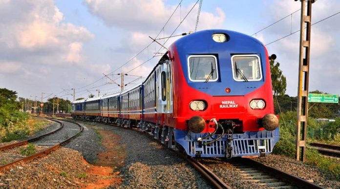
New Delhi (NVI): The Nepal government today conducted a test drive of two brand new Indian-built trains on the 45km Jayanagar-Janakpur line, amid border issues with India.
The new trains will be operated by Nepal Railways after India sent its railways officials to coach Nepal technicians to operate Janakpur-Jaynagar route.
According to the contract signed between the Nepal and Indian Railways board, a total of 26 Indian Railway officers were sent to Nepal with rolling stock.
The railway project is being undertaken with Indian government assistance, and the broad gauge tracks are being laid till Bijalpura, the Nepali Times reported.
According to the news website, the Jayanagar-Bijalpura narrow gauge line is not new, and had been built during British India in 1937 and used steam locomotives till it went out of service in 2001 after bridges were washed away in a flood.
In the beginning, both the Amelkhganj and Bijalpura railways were used by the British to transport logs from Nepal’s Tarai forests for railway sleepers in India, it reports.
The Raxaul-Amlekhganj tracks were built by the British in 1927 and transported dignitaries who could take jeeps to Bhimphedi for the three-day trek to Kathmandu. The seven Garratt steam locomotives were in use till 1965, when they were replaced by the highway to Kathmandu, reports Nepali Times.
Besides the Janakpur train, the only other railway line in Nepal at present is the 6km broad gauge from Raxual to the Sirsiya Inland Container Port that connects landlocked Nepal to sea ports in India. It was inaugurated in 2005, and serves as an important link for Nepal’s trade with the outside world.
Interestingly, the development comes when Nepal has introduced new text books in the school curriculum that include the country’s revised political map showing three strategically-important Indian areas as part of its territory.
India has already termed as untenable the “artificial enlargement” of the territorial claims by Nepal after its Parliament unanimously approved the new political map of the country featuring Lipulekh, Kalapani and Limpiyadhura areas which India maintains belongs to it
The book has been introduced by Nepal education minister Giriraj Mani Pokharel who has also written its preface. The book includes the disputed area of Kalapani in Uttarakhand as Nepal’s territory. The book also mentions that Nepal has a geographical area of 1,47,641.28 sq km, of which 460 sq km is the Kalapani area.
All these developments take place in the backdrop of strain in the relations between the two countries. The strains emerged after Defence Minister Rajnath Singh inaugurated a strategically crucial road connecting the Lipulekh pass with Dharchula in Uttarakhand on May 8. Nepal protested it, claiming that it passed through its territory.
Days later, Nepal came out with the new map showing Lipulekh, Kalapani and Limpiyadhura as its territories. Subsequently, in June, Nepal’s Parliament approved the new political map of the country featuring areas, which India maintains belong to it. India termed the move as “artificial enlargement” of territorial claims by Nepal.
-ARK


