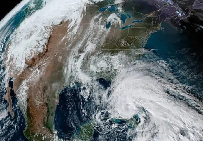
New Delhi (NVI): Tropical Storm Eta is tracking near South Florida, where heavy rainfall, strong winds, storm surge and high surf are expected to continue today.
Eta made landfall in the Florida Keys at Lower Matecumbe Key on Sunday night. This is the 12th named storm to make landfall in the US this hurricane season and the first for the state of Florida.
The center of Eta is now located just off the southwest coast of Florida.
Furthermore, tropical storm warnings have been issued for the northwestern Bahamas and South Florida from the Brevard-Volusia County line to Anna Maria Island. This includes Nassau, Grand Bahama Island, the entire Miami metro area and the Florida Keys. This is where tropical storm conditions are expected generally through Monday.
Meanwhile, bands of heavy rain and gusty winds continue to feed into the Florida Keys and South Florida.
Tropical-storm-force winds extend outward up to 310 miles from the center of Eta. That means a large part of South Florida could see winds gust to tropical storm strength (39+ mph) at times tonight.
However, the forecast for Eta’s future track and intensity remains highly uncertain. In the near-term, Eta is expected to track southwestward toward the western tip of Cuba by early Tuesday. That’s due to the steering influence from Eta’s interaction with an upper-level low-pressure system in the Gulf of Mexico, and an area of high pressure off the Southeast U.S. coast.
After that, Eta is expected to lose steering influences, meaning it will slow down significantly or even stall over the eastern Gulf of Mexico.
Storm Eta previously made landfall on the south-central coast of Cuba early Sunday.
-CHK


